Including a map to a report
Including a map to a report
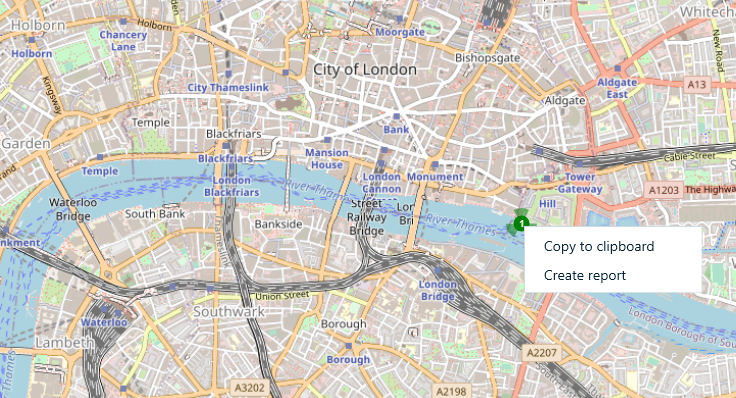
You can generate a report for geolocation artifacts shown on Open Street Maps window of Belkasoft X, and it will automatically include current map into the report. To do so, tune the map using your mouse: move the map by holding left mouse button and moving your mouse, zoom in or out using (+) or (-) buttons located at the bottom right corner or by using the mouse wheel. When you are satisfied with the view, right click on the map and select Create report… context menu item.
The product will show you a simplified version of report options, since this kind of report is available only in PDF format:
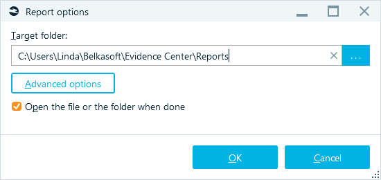
Some advanced options, e.g. Formatting and Style options are available to you.
See also:
Creating reports
Report options
Including a connection graph to a report